
Site Location : Anne Arundel County
Website : www.aacounty.org/RecParks/launch/patuxent_wetlands.cfm
Coordinates : E 38-50-28N 76-41-54W
Address & Directions from a Major Highway :
1426 Marlboro Road
Lothian, MD 20711
Located at the east end of the Hills Bridge crossing, on the north side of Route 4, near Wayson’s Corner.
From Annapolis, take Route 2 (Solomon’s Island Road) south. At Route 408 (Mt. Zion Marlboro Road) make a right and go west. Bear right onto the access road just before Route 4 entrance ramp and after a gas station. Go to the end of the entrance road by the Route 4 bridge to access parking lot. Signs are posted.
Public or Private : Operated by The Maryland Department of Natural Resources
Site Access (days & hours) : Not restricted
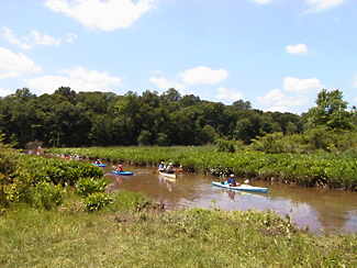
Special Interests (museum, fishing pier, swimming pool, etc.) : Launching only. Popular fishing site.
Fees : Free
Wheel Chair Access : Yes
Toilets : No
Picnic tables : No
Camping : No
