
Site Location : Montgomery County
Website:http://www.wsscwater.com/home.html
WSSC MapLink : http://www.wsscwater.com/education-and-recreation/educational–recreational-activi/watershed-protection/watershed-maps-and-directions.html
Coordinates : SW 39-08-43N 76-57-46W
Address & Directions from a Major Highway:
From Route 29 (Columbia Pike), take Exit 13 onto Route 216 west. In about one mile, make a left onto Lime Kiln Road. This is actually at a fork in the road, with the right fork continuing as Route 216. Take Lime Kiln Road to the stop sign. Make a left onto Brown Bridge Road. To get the Howard side of the kayak ramp, make a left just before your cross the bridge onto a concrete access road that leads to the launch area. To get to the Montgomery County side you must cross the bridge and then make an immediate left at the blue colored “Brown’s Bridge Recreational Area” sign. The launch ramp is about a half mile on the left.
Note: There is limited parking on the Howard County side. So there is a short walk from the parking area in order to launch your kayak. The Montgomery County side has more room and allows you to launch directly to the water from a trailer or truck.
Public or Private : Operated by The Washington Suburban Sanitary Commission
Site Access (days & hours) : Launching is permitted while the watershed properties are open. This is generally mid-March through November 30th, open 30 minutes before sunrise to sunset.
WSSC enforces a “No Trespassing” regulation with regard to watercraft near its dams. A buoy line approximately 400 yards from the face of the dam has markings to warn boaters of getting too close.
WSSC also enforces a “No Trespassing” regulation on its shoreline property. This means that boaters may not dock or come onto WSSC property anywhere other than designated boat morring and launching sites.
Main line: 301-206-7485
Check conditions at 301-206-4FUN (4386)
WSSC Police: (to report illegal activities on the reservoirs) 301-206-8888
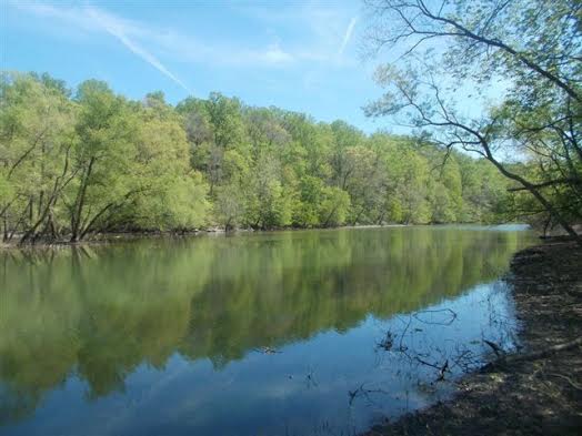
Special Interests (museum, fishing pier, swimming pool, etc.) : Triadelphia (Brighton Dam) and Rocky Gorge (T. Howard Duckett Dam) Reservoirs are surrounded by 6,000 acres of wooded property that comprises the WSSC portion of the Patuxent watershed. Both properties store a combined surface area of 1,600 acres of raw water which is used to supply customers in Prince George’s and Montgomery Counties.
WSSC sponsors a recreational program on the watershed which allows visitors to pay a fee for engaging in fishing from portions of the shorelines of reservoirs; fishing and recreation boating on large areas of the reservoirs; mooring of personal boats; hiking and horseback riding on designated trails;picnking, and hunting in specific areas.
Parking: (number of spaces, distance to the water) : More than 10
Fees : A Watershed Use Permit fee ($6 daily – $70 annual) is required to engage in recreational activity on the watershed. There is free access for handicapped and under 16 and over 64 years of age. An additional $80 is charged to Season Permit Holders (individuals) wishing to moor a boat at a watershed site. Permits can be purchased at the Brighton Dam Information Center daily located at:
2 Brighton Dam Road
Brookville, MD 20833
Or, the Cashier’s Office, located at:
14501 Sweitzer Lane
Laurel, MD 20701
View the full list of permitted activities and watershed regulations here http://www.wsscwater.com/watershedregs
Wheel Chair Access : Yes
Toilets : Yes
Picnic tables : Yes
Camping : No

